
Features Farm Boundaries
Introducing "Farm Boundaries," an innovative app designed to revolutionize the process of generating and sharing KML (Keyhole Markup Language) files by creating accurate farm boundaries through walking.
With this user-friendly application, farmers and landowners can effortlessly map out their farm boundaries, streamline their land management processes, and collaborate effectively with others.The Farm Boundaries app harnesses the power of GPS technology, enabling users to walk along the perimeters of their farms while the app automatically captures precise location data.
By simply tracing the farm boundaries on foot, users can create accurate digital representations of their land holdings with ease.
This intuitive method eliminates the need for complex surveying equipment or expensive third-party services, empowering farmers to take control of their land mapping activities.One of the key advantages of the Farm Boundaries app is its ability to generate KML files.
These files contain detailed information about the farm boundaries, including coordinates, polygon shapes, and other essential metadata.
By exporting these KML files, users can seamlessly integrate their farm boundaries into a variety of mapping platforms, such as Google Earth or GIS (Geographic Information System) software.
This compatibility enhances the versatility and interoperability of the farm boundaries, enabling users to leverage them in diverse applications, ranging from land planning and zoning to environmental monitoring and precision agriculture.Sharing farm boundaries with stakeholders and collaborators has never been easier.
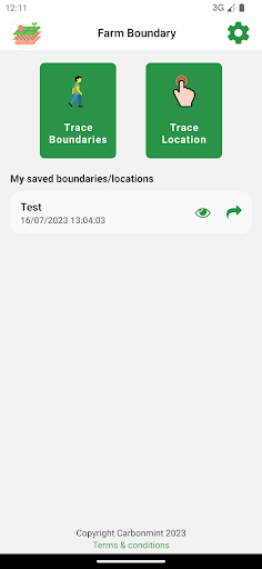
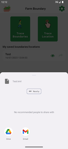
The Farm Boundaries app allows users to effortlessly share their KML files with others, promoting collaboration and facilitating effective communication.
Whether its sharing with agronomists, farm managers, or other team members, the app provides a simple and efficient way to ensure everyone has access to accurate and up-to-date farm boundary information.
This collaborative approach improves coordination, minimizes misunderstandings, and enhances overall productivity in farm management practices.The Farm Boundaries app goes beyond the core functionality of boundary creation and sharing.
It offers additional features to enhance the user experience and provide comprehensive land management capabilities.
Users can annotate their farm boundaries, adding custom labels or notes to specific areas of interest.
This feature allows for efficient data organization and provides valuable context for future reference.
Furthermore, the app provides the ability to measure distances, areas, and perimeters within the farm boundaries, enabling users to gain valuable insights and make informed decisions about their land.Security and privacy are paramount when it comes to farm data.
The Farm Boundaries app prioritizes the protection of user information and farm boundaries.
All data is securely stored on the users device and can be backed up to cloud services for added peace of mind.
The app adheres to strict data privacy standards, ensuring that sensitive information remains confidential and accessible only to authorized individuals.In summary, "Farm Boundaries" is a groundbreaking app that revolutionizes the way farm boundaries are generated and shared.
By enabling users to walk their farm perimeters and automatically capturing accurate data, the app simplifies the mapping process and empowers farmers to take control of their land management activities.
With the ability to generate KML files, share boundaries, and access additional features for data annotation and measurement, this app is a comprehensive tool that optimizes farm management practices.
Embrace the power of "Farm Boundaries" and unlock the true potential of your land.
Social Features
Connect and share with friends and the community.
Fitness Tracking
Track your workouts and monitor your health metrics.
Productivity Tools
Boost your productivity with powerful tools and features.
See the Farm Boundaries in Action

Get the App Today
Available for Android 8.0 and above